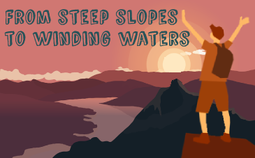
New long-distance hiking trail crosses Czechia from west to east

A new long-distance hiking trail has recently opened in the Czech Republic. Cesta Českem or Czechia Trail leads along the country’s northern borders from the westernmost point to the so-called Trojmezí, a point at which the Czech, Polish and Slovak borders meet. It measures 1,000 kilometres and takes approximately 40 days to complete, its creators say.
I spoke to Martin Úbl, the person behind the project, and started by asking what made him create the hiking trail in the first place:
“There are many established hiking trails here, but something like this one, with a defined structure, GPS points, itinerary and a website with all the information, was missing here. That’s why we created it.
“And who is it intended for? The motto of our trail is that everybody can make it. So I think it is for two kinds of hikers. Those who would like to start hiking, but they don’t know how and they feel a bit intimidated.
“Even though it is such as small country in the middle of Europe, you can still come across some completely abandoned places.”
“And those who already have some experience but they are looking for something new. Maybe they are looking for a new challenge or maybe they would just like to see our country from a slightly different perspective.”
The track goes along the northern border of the Czech Republic, with mountains stretching along most of the way. Can you describe it in greater detail?
“As you said before, the track starts at the westernmost point of the Czech Republic, and ends at the easternmost point. It measures approximately 1000 kilometres and goes through nine mountain ranges.
“It is divided into ten parts and gives you a chance to visit a number of local and national parks. So that’s why we decided to lead it along the country’s norther border.”

As you said, the track leads mostly through mountain areas. How demanding is it?
“As I said before, it is of course demanding, because 1,000 kilometres is quite a distance. But I would say it is not as demanding as you would expect.
“I think that if you are in average physical condition and you have at least some experience or prepare yourself in advance, you can do it.
“Looking at the feedback that we have received so far, people who are interested in the track are of various ages, they want to walk with their families and children or with their dogs, so I would say it is really for everybody.”
It says on your website that the track can be completed within 40 days. Did you yourself walk the whole track? And if so, how long did it take you?

“Forty days is some kind of an estimate, assuming that an average hiker should be able to walk about 25 kilometres a day. In these conditions, it is not such a huge challenge. But I can imagine that some hikers will be faster and some slower. It is not a competition.
“As far as we are concerned, yes, we walked the whole track, because we had to prepare it, we had to measure and describe everything. It wasn’t just about walking, we needed to spend more time on the trail.
“So we didn’t cover the track from the start to an end, we had to split it. That said, it is a chance for someone to be the first one.”
So which part of the track was your favourite?
“It’s a very difficult question, because the mountains have a different atmosphere. So I would recommend the hikers to walk the whole track and decide for themselves which part is their favourite.
“There are some really hidden places but also Krkonoše, which everybody knows, so it really depends.”
Was there something that you discovered only when creating this trail?
“I was definitely surprised by some mountains that I haven’t visited before. I come from the Western part of the Czech Republic so I haven’t been to the eastern mountains many times. Even though they are not that well-known, they are very beautiful. I was also surprised that even though the Czech Republic is such as small country in the middle of Europe, you can still find here some remote and completely abandoned places.”
Can you be more specific? Which mountains are you talking about?
“Each part of the hike has its own itinerary which can be downloaded on our website.”
“It is mainly those that are difficult to reach by car, such as the westernmost point and western part of Krušné Hory, which is almost abandoned.
“Lužické Hory are very beautiful and there are not so many tourists, and also Broumovská vrchovina and Rychlebské hory on the border with Poland, which are almost completely empty.”
Are there places to stay along the trail, such as camping sites or hotels, and places to eat?
“Yes, it’s one of the biggest advantages of this project. Each part of this hike has its own itinerary which can be downloaded on our website cestaceskem.cz.
“Here you can find all the necessary information to organize your trip according to your needs: places to sleep or eat, emergency shelters, water sources, and even links to various organisations.
“So it’s up to everybody how they want to manage their track. If they want to sleep in a tent, if they want to eat in a restaurant or cook their own meals. They have all the information on the website and it can be downloaded for free.

“As for us, we sometimes slept in a tent and sometimes without it, it really depended on the weather.”
What is the best time of year to set on the trail?
“I would say that if you start in late April or May, it should be fine. If you manage your hike before the end of September, that should also be fine. But there are hiker walking along the track right now. So it is possible even in November.”
What kind of feedback have you received so far from the people? How many people have already completed the track?
“I am pretty sure no-one has yet completed it, because we only created the track about four weeks ago, so they wouldn’t be able to make it so fast.
“However, there are people on the track right now. There are also people who walked just a part of the track, maybe a few kilometres, and they will continue either next year or next weekend. And actually we are really surprised by the huge and positive feedback.”
I know that you would like the track to become part of a network of Europe’s long-distance track. What are the requirements for that to happen?
“This is a little bit tricky because it involves a lot of bureaucracy, which is really demanding for us. Luckily, we are cooperating with the Czech Republic’s main tourist organisation, the Czech Tourist Club.

“They are responsible for the communication with this international organisation. We are in touch with them and I think we have found a way to promote our hike even on a European level.
“There are some specifics that need to be met but fortunately we don’t have any deadline. So people can still use our trail and this is something we are working on in the background.”
I know you have travelled all around the world. What do you like about hiking in your homeland? In what way is it specific?
“In some way it is easier. We hiked in very high altitudes, above 5,000 meters, and slept in altitudes above 4,000 metres. We also hiked some of the world’s most difficult trails in Nepal and the Great Divide Trail in Canada, which is really demanding.
“So in this respect, it is easier, because you are in your natural environment and you can speak your language. I would say it is more about exploring your nature, meeting people and discovering hidden villages. That’s the biggest difference. For me, walking the trail was really like a vacation.”
And finally, do you plan to create any other trails here in the Czech Republic, for instance along the Southern border?
“Actually, our first idea was that the trail would lead along the southern border but then we switched to the northern border. Our plan was that we might build the southern trail sometimes in the future, depending on how successful the first part is.
“But when we see the amazing feedback from the people and how successful this project already is, I think we will probably start to build the Southern trail next spring.
“So I am really looking forward to that and I am also looking forward to the next hiking season and to all the travellers who will join us next year.”